

What is GIS?
| -Let’s first define
Geographic Information Systems: GIS is a system used to collect, integrate,
analyze, model, and display digital information related to the earth’s
surface. |
|||
| -ArcView 3.2 was used as our
Geographic Information System in order to create maps. |
|||
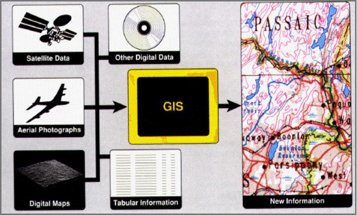
| -If you refer to the
graphic, you can see that various types of data can be inputted into GIS in
order to produce a sophisticated graphic. |
|||