To produce models based on digital
forms of existing maps,
aerial photographs, and field survey information
ModelBuilder
-The objective of the GIS
group was to produce models based on the maps created by ArcView using
ModelBuilder in order to find effective management strategies.
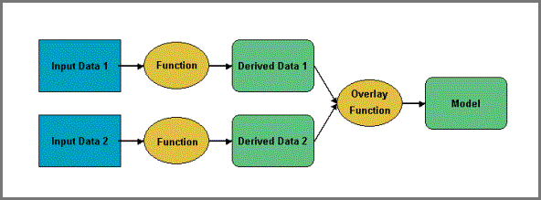
-This flow chart is a
representation of the processes that ModelBuilder goes through in order to
create a model.
-Blue Rectangles represent
maps created by ArcView (Input data)
-Yellow Ovals represent
functions that convert ArcView maps into numeric value maps (Green rectangles
with rounded sides) so that multiple maps can be combined.