|
|
|
|
|
Construction
|
|
-There are three main
factors that influence erosion. These are percent slope, soil type, and
landuse type.
|
|
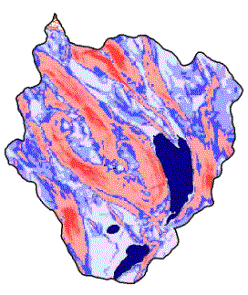
1) Percent slope was derived
in ArcView using contour data from the Maine Office of GIS. Areas with a high
percent slope are denoted by dark red, and areas with a low percent slope are
denoted by blue.
|
|
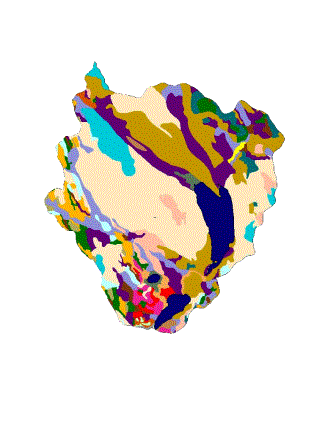
2) The soil map was created
by ArcView. This map is simply a digital version of the USDA soil map. Each
color denotes a specific soil series. Ex. This color represents the Thorndike
soil series.
|
|
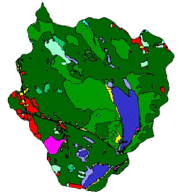
3) The Landuse map, provided
by the landuse group
|