

Development Suitability Model
| Analysis |
|||
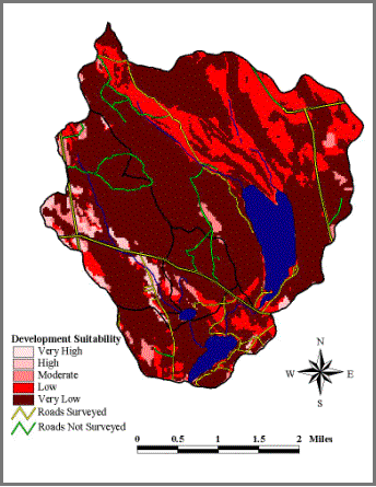
| -The light red regions on
the map denote areas of high development suitability or in other words: areas
that do not need extensive mitigation for development |
|||
| -Areas that were identified
as “high” in the Development Model are for the most part already
developed. Look at Rt.2. |
|||
| -Without mitigation, there
is little natural land to development in the Lake George/Oaks Pond combined
watershed; this is due to the general shallow soil layer, which inhibits the
construction of septic systems and basements. |
|||