

Road Survey Results
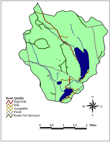
| This is a map we created
showing the location and score of roads within the watershed. |
|
| Paved roads -gray |
|
| High risk-red |
|
| Risk-orange |
|
| Acceptable-yellow |
|
| Certain roads not found, or
entrance was gated off- were not surveyed and are depicted here in green. |
|
| As you can see, many camp
roads located close to the shoreline- which have the potential to add more
nutrients than those farther away. |
|
| It is important to address
the issues I mentioned for improving these roads in order to minimize their
negative impacts on water quality. |
|