�Visualization of geographic features and
the corresponding physical attributes
�Road map
�Land use type
�Soil map
�Contour map
�
�Modeling of natural processes using Arc GIS�
Spatial Analyst
�
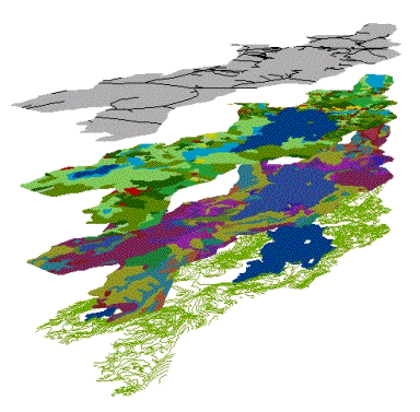
A computerized
GIS consists of layers of independent maps that each contain specific
information associated with a geographic area.The simplest application of this is creating basic
maps.On the screen are four
maps of the Threemile Pond Watershed and the names of each are listed.The top is a road map, the next one
is the 1998 land use map Kelly talked about before the break, the next is a
soil map, and the bottom one a contour map.GIS was also used to make a bathymetry map, a lake buffer
map, and the sample location map all of which will be seen later in the
presentation.
Another application is
modeling.This displays the
cumulative effect of several factors in a geographic area and this is what I
will focus on.