Proximity Maps
8
¥Lake proximity zones
Ð200 ft
Ð1,200 ft
¥
¥Stream proximity zones
Ð200 ft
4
6
5
3
2
1
7
8
9
6
7
8
8
5
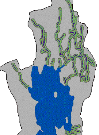
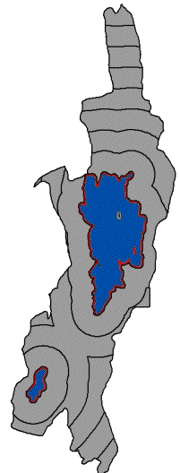
The proximity maps were the fourth and fifth input maps into the erosion model.  Erosion at one extreme of the watershed is not as likely to directly affect water quality as erosion right on the lake shore.  We created proximity zones around Threemile Pond and Mud pond to account for this.  The red line is a 200 ft zone to indicate shoreline area.  The distance to the furthest most part of the watershed was divided into 8 more zones each 1,200 ft in width.
   However, erosion far from the lake may have a large impact on water quality if located near a stream.  Streams carry runoff from the surrounding land directly to the lake.  Nutrients in the runoff are not absorbed by plants as they would have been on land.  200 ft zones were created along each stream represent this increase in the potential impact to water quality.  They were given an 8 on the 1 to 9 scale.