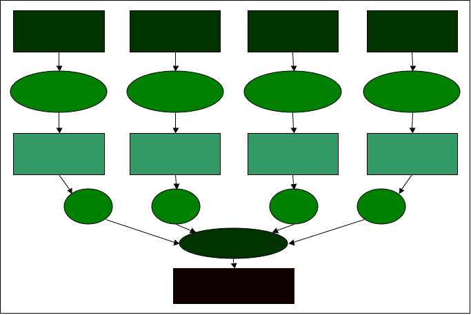
Erosion Potential Model
Elevation Raster
Soil Map
Land Use Map
Slope
Vector to Raster
Vector to Raster
Raster Slope Map
Raster Soil Map
Raster Land Use Map
40%
25%
25%
Raster Calculator
Erosion Potential
Watershed Boundary
Buffer Polygons
Raster Proximity Map
10%