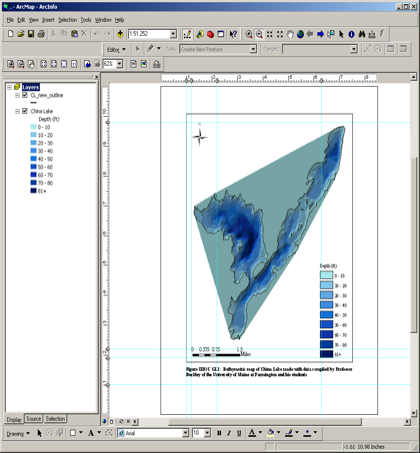
Geographic Information System
�Geographic Information System (GIS)
�A computer system based on a common coordinate system designed to display, manipulate, and analyze geographic data
�A computer system based on a common coordinate system designed to display, manipulate, and analyze geographic data