�Can add, manipulate, or create new data, represented by points, lines, or area (polygons)
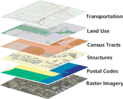
Within GIS, geographic data
is represented as layers. Data can range from points, lines or an area
depending upon what is being represented. Layers can be overlaid and compared
to determine relationships or differences between data.