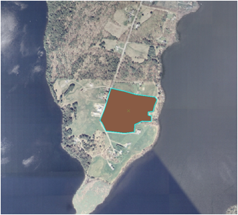
Creating Polygons
�
Designating land use types within GIS
Outline land use type in GIS by drawing polygons around identified areas, complete for the entirety of both watersheds in both the 1965 and 2003 surveys