
Example of DOQ Interpretation
�Shoreline Residential
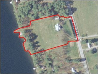
| Example of DOQ
interpretation |
|
| Two enlarged images; high
resolution lets you see features |
|
| Using ArcGIS, can draw
polygons around areas of similar land use; continued this process until the
entire watershed was filled. |
|
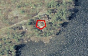
| Example of one of the many
decisions we encountered during the polygon-creation process |
|
| These are examples of the
polygons that were made and once the entire watershed was filled, we could
calculate the area of each type.
For residential land, polygons for a house-lots extended wherever
human-influence was noticeable, such as with a lawn for boathouse. |