|
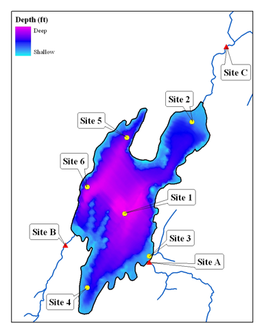
Here is a map showing all of
the lake sites and tributary sites where sampling occurred. Site1, in the middle of the lake, is
the same site used by the Maine Department of Environmental Protection, and
this site was used so that we could make comparisons between our results and
previous results from Pattee Pond studies. Sites 2 through 5 were studied throughout the summer and
were chosen to look at water quality parameters at different locations around
the lake. Site 6, along the
western shore, was added in the fall.
Sites A and B are on the major inlets to the lake, Farber Brook and
Bellows stream, and Site C is on the major outlet of the lake, Pattee Pond
Brook. I am now going to talk
about various parameters that affect water quality. [Click to next slide]
|